Boggess Well Pad Interactive 3D Visualization
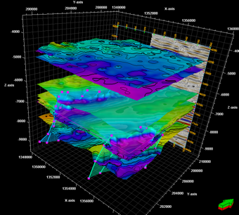
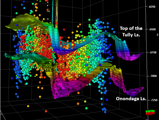
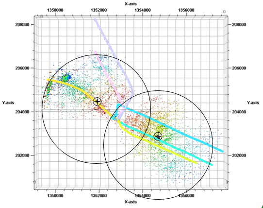
Beta version of a fully interactive 3D visualization of the Boggess wells, microseismic data, and logs.

The objective of the Marcellus Shale Energy and Environment Laboratory (MSEEL) is to provide a long-term field site to develop and validate new knowledge and technology to improve recovery efficiency and minimize environmental implications of unconventional resource development.
Beta version of a fully interactive 3D visualization of the Boggess wells, microseismic data, and logs.
Researchers search for life deep in the shale rock. The microbes have potential to improve oil and gas drilling at incredible depth.
This news spotlight details how WVU built the first-ever field laboratory for long-term shale gas study.
WBOY 12 reports a USGS finding showing little fracking pollution in the Monongahela River.
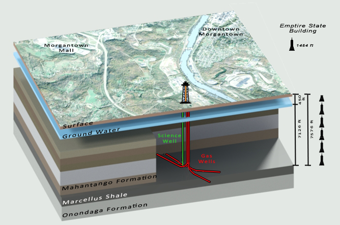
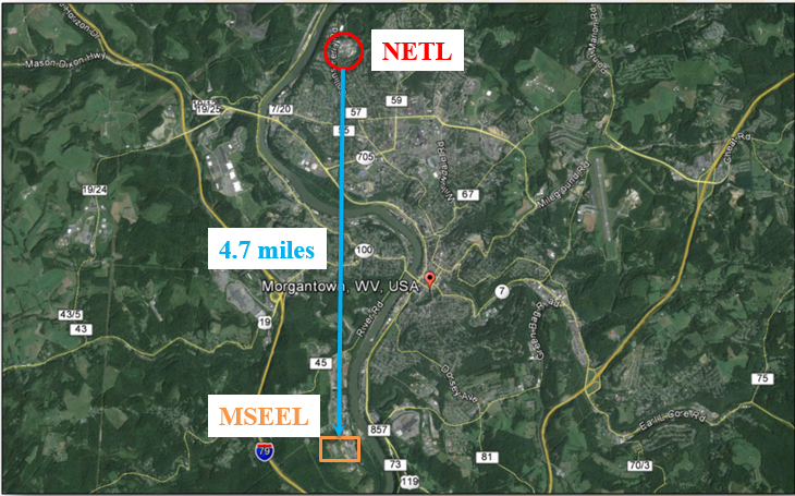
DOE's NETL, WVU, NNE, and Ohio State monitor unconventional gas production at a Marcellus Shale well near Morgantown.
Our work has the potential to impact everyone from citizens to scientists. Here we keep the public informed about the science and data that matter.
The objective of the MSEEL project is to understand unconventional shale reservoirs via reservoir characterization, horizontal well monitoring, and study societal/environmental impacts.
Molecular, isotopic, geochemical, microbial, noble gas, and physical characterization of core, fluids, and gases.
Evaluating production relationship to microseismic event distribution.
Characterize temporal changes in liquid/solid wastes, air, noise; identify exposure pathways and develop protective strategies.
Evaluate governmental economic and societal impacts.
Images display the varied research work being done by the MSEEL research team.

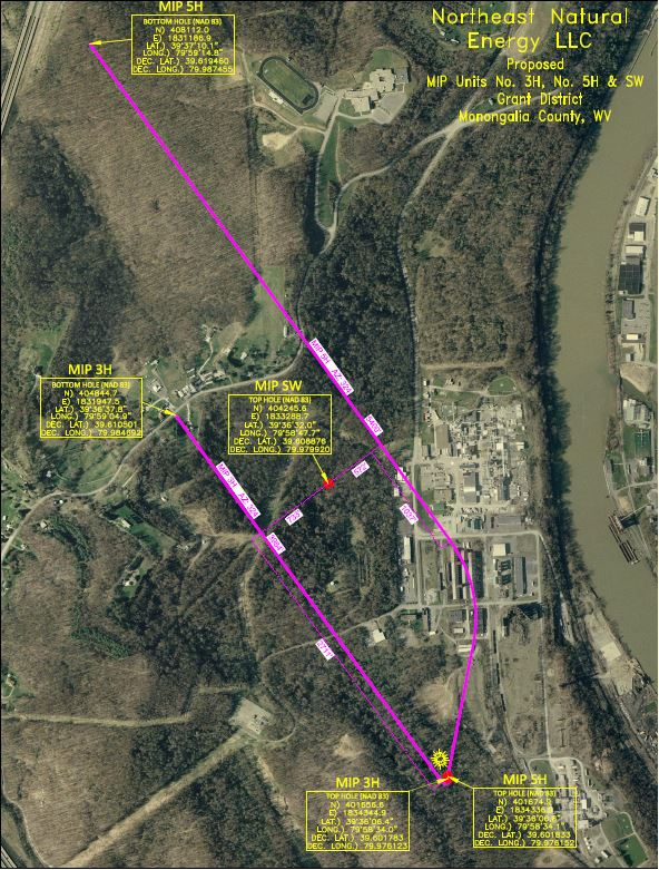


Well production for MIP-3H, MIP-5H, MIP-4H, and MIP-6H.
Download MIP Gas Production Data (all wells)
Download Excel Sheet
The MSEEL site provides a well-documented baseline of reservoir and environmental characterization. Access to multiple Marcellus wells separated by sufficient time allows collection of samples and data, and testing advanced technologies. The phased approach provides flexibility to incorporate new, cost-effective solutions focused on increasing recovery efficiency while reducing environmental and societal impacts.
MSEEL research team collaborates across West Virginia University and the Department of Energy.